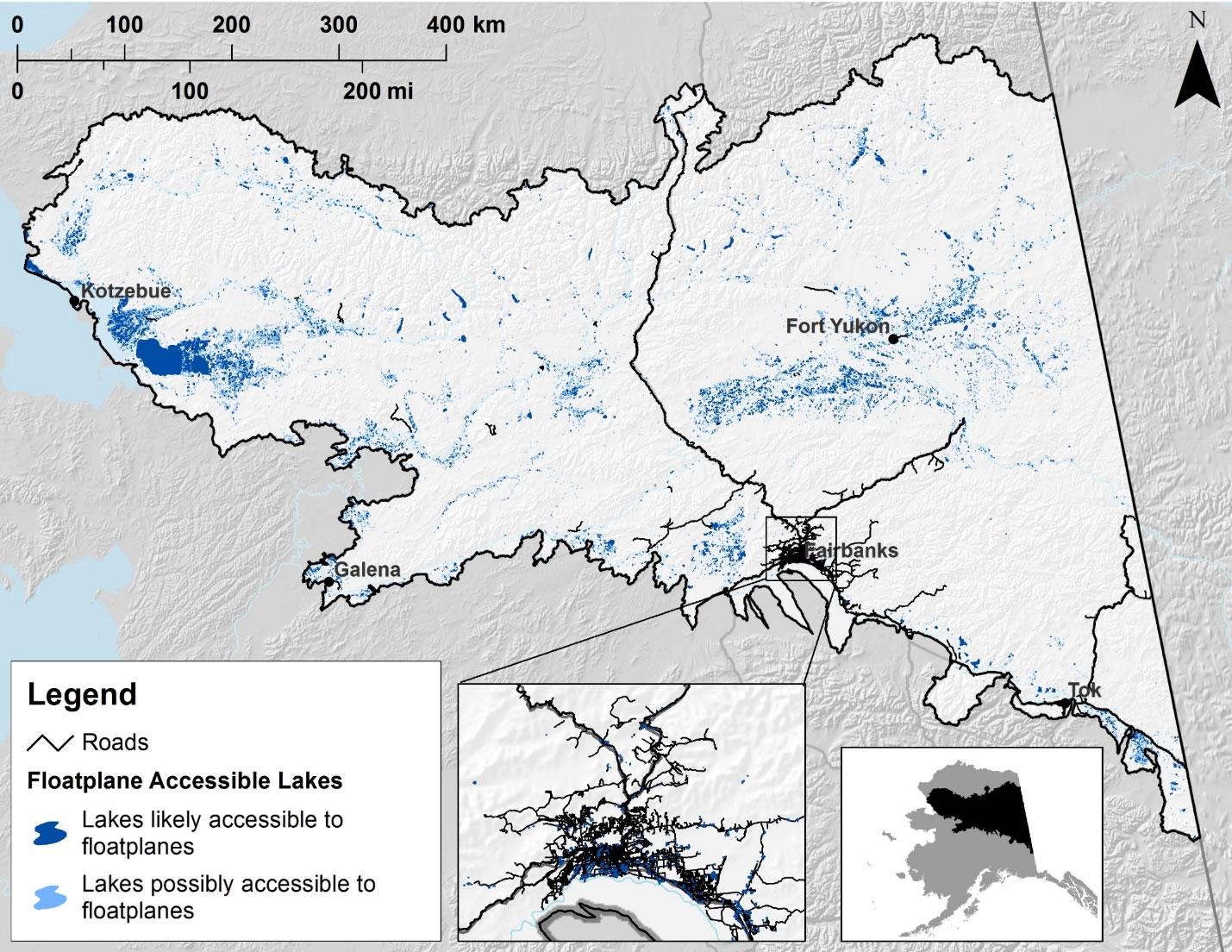
Floatplanes are a potential vector for Elodea introductions and we therefore identified lakes ≥ 1 km in length along their longest axis as “likely accessible” by floatplane and those 0.5 to less than 1.0 km in length as “possibly accessible”. This distance criterion was developed based on a review of lakes used for floatplane landings in the Kanuti National Wildlife Refuge. Other features such as lake depth or shape, presence of obstructions, high waves, lack of appropriate approach to shore, etc., may result in inaccessibility of lakes longer than 1 km; however, these features are not readily assessed with GIS or other datasets at hand. Additionally, this approach only considers a component of the likelihood of Elodea transport and does not encompass habitat suitability (e.g., lake depths less than 9 feet, pH from 6.0-7.5, etc.), or probability/frequency of landings (e.g., lakes closer to urban centers, or those with greater recreational uses). Over 1,500 lakes and ponds are road accessible in the study area, with the majority located in the Fairbanks-North Pole area where Elodea is already known to occur. Elodea infestations in the state are primarily known from shallow lakes and ponds, indicating these waterbodies are particularly at risk. We identified 3,500 lakes in the region that are likely floatplane accessible, in which waterweed may be accidentally transported on float rudders. Smaller lakes with marginal accessibility to aircraft number nearly 11,000 in the study area.
Data and Resources
- Floatplane Accessible Lakes in Interior Alaskazip
Floatplanes are a potential vector for Elodea introductions and we therefore...
Download - Central Yukon REA Final Reportpdf
The assessment area, referred to in this REA as the Central Yukon (CYR)...
Download
| Field | Value |
|---|---|
| Modified | 2025-10-03 |
| Release Date | 2018-02-23 |
| Frequency | Irregularly |
| Identifier | 9fd02fdb-a972-4e80-b657-b23a020ee13d |
| Spatial / Geographical Coverage Area | POLYGON ((-142.734375 62.955223045159, -140.3173828125 62.14497603754, -140.2734375 68.675540078517, -143.0859375 69.118548200771, -145.283203125 69.236684232389, -146.689453125 69.243498967199, -149.150390625 69.099939674251, -151.611328125 68.656554984757, -153.7646484375 68.608520846399, -155.6982421875 68.736383452873, -156.97265625 68.992879045794, -159.697265625 69.118548200771, -162.94921875 68.643555900788, -164.267578125 68.223580287685, -164.794921875 67.359957410029, -162.861328125 66.323170560792, -161.279296875 65.643553293069, -159.609375 65.131103353073, -157.5 64.796356791179, -155.302734375 64.796356791179, -153.30322265625 64.699105442048, -150.380859375 64.358930978945, -148.73291015625 64.086606778817, -147.7001953125 63.913227674248, -146.865234375 63.782486031165, -144.052734375 63.312682780435)) |
| Spatial / Geographical Coverage Location | Interior, Alaska, USA |
| Language | English (United States) |
| License | |
| Author | |
| Data Dictionary | |
| Public Access Level | Public |

![[Open Data]](https://assets.okfn.org/images/ok_buttons/od_80x15_blue.png)
