![[Open Data]](https://assets.okfn.org/images/ok_buttons/od_80x15_blue.png)
Alaska Center for Conservation Science, in partnership with the Chugach Regional Resources
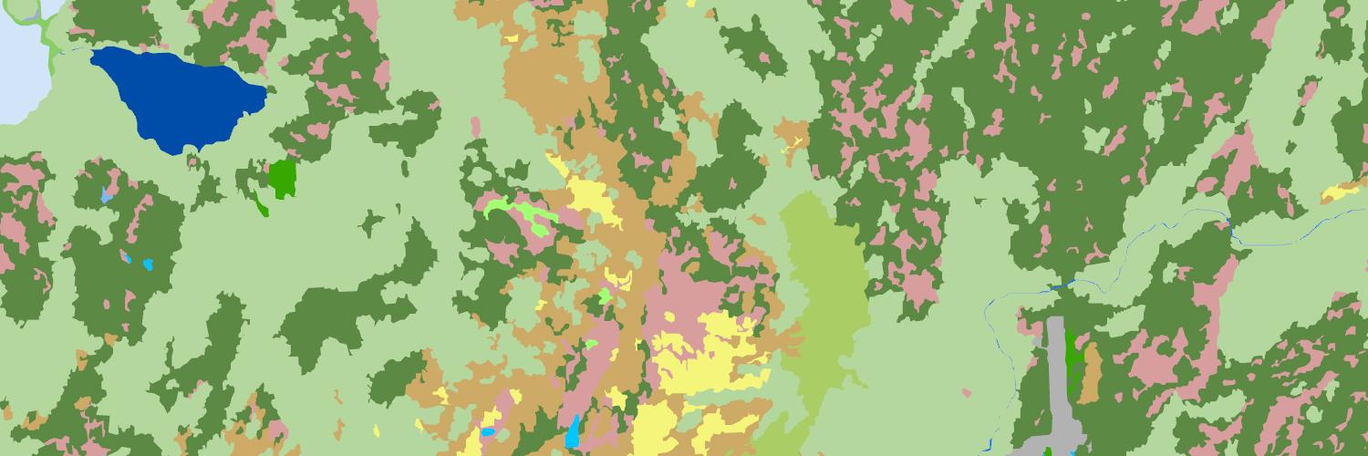
Commission and the U.S. Fish & Wildlife Service, present a vector-based digital map for Alutiiq tribal lands in the western Prince William Sound region of Southcentral Alaska. This map was developed to connect patterns of subsistence use to habitat types in the Chenega region. Each mapped habitat type is accompanied by a summary document describing the biophysical characteristics of the habitat and traditional subsistence use of native plant species it supports.
Study Area
Our updated wetland and deepwater map covers the Evans Island – Latouche Island watershed,
located in western Prince William Sound between the communities of Seward and Whittier. In
addition to a peninsular portion of the mainland, the study area includes the Latouche, Elrington, Evans,
and Bainbridge Islands.
Data and Resources
- Project Reportpdf
Includes methods for producing maps and compiling subsistence use data in...
Download - Taxa and Associated Habitat Tablespdf
Includes tables of terrestrial and marine species (animal and plant),...
Download - Geospatial Habitat Datazip
ZIP file includes an ESRI shapefile and an ArcGIS Pro LayerFile. The...
Download - Interactive Web Map
Interactive, web-based application to view mapped habitats. Users can zoom...
Go to resource - [Habitat Type] Mountain Hemlock Wetland Forestpdf
Description of the Mountain Hemlock Wetland Forest habitat type, including a...
Download - [Habitat Type] Ocean Water and Kelp Bedpdf
Description of the Ocean Water and Kelp Bed habitat type, including a...
Download - [Habitat Type] Sitka Alder - Salmonberry Shrublandpdf
Description of the Sitka Alder – Salmonberry Sideslope Shrubland habitat...
Download - [Habitat Type] Subalpine Mountain Hemlock Woodlandpdf
Description of the Subalpine Mountain Hemlock Woodland habitat type,...
Download - [Habitat Type] Tidal Herbaceous Wetlandpdf
Description of the Tidal Herbaceous Wetland habitat type, including a...
Download
| Field | Value |
|---|---|
| Modified | 2026-02-09 |
| Release Date | 2025-12-19 |
| Identifier | ae683bf9-f67b-40d2-ac68-beb446f34426 |
| Spatial / Geographical Coverage Area | POLYGON ((-148.14871245995 60.180976451596, -148.16848771647 60.141618678668, -148.1728823483 60.104404161869, -148.18386867642 60.060568482701, -148.19815093651 60.026555724535, -148.23550438508 59.978769049118, -148.24868794531 59.929812351893, -148.18057274446 59.894562856054, -147.99160793424 59.911641512551, -147.87185685709 59.962274874292, -147.80593888834 60.063858172204, -147.84109527245 60.123016690018, -147.89602691308 60.181522757543, -147.9992983304 60.217013018862, -148.03555324674 60.223015268252)) |
| Language | English (United States) |
| License | |
| Author | |
| Contact Name | Flagstad, Lindsey |
| Contact Email | |
| Public Access Level | Public |